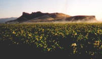
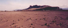
 1905 |
 2000 |
 2001 |
 1905 |
 2000 |
 2001 |
|
1/28/07 Greetings to KBC from Andrew Orahoske, (KBC response follows) I'm trying to understand your website. At the top of the home page, you have three pictures. The first one taken in 1905 shows a lake and wetland, which I would assume is the historic Tule Lake. I have visited the Captain Jack Stronghold area and have seen the evidence of shores of this lake as they existed a century ago. Tule Lake was enormous and seasonal, receiving waters from the surrounding hills, the Lost River, and the Klamath River spilling out of Upper Klamath Lake, bursting with spring snow melt. From what I understand, after 1905 Tule Lake was drained by the Bureau of Reclamation for the "Klamath Project" to create farmland. This is what I would guess is shown in the second picture, 2000, on your website, the lake replaced by an agricultural landscape. What is left of Tule Lake is now confined to a few ditches and lagoons regulated by the Fish and Wildlife Service. With all the water gone from Tule Lake because
it was entirely drained, the area is now reliant
upon the Klamath Project for irrigation water,
which is sometimes in short supply. This is what
is pictured in the last picture from 2001, when
the Klamath Project did not have enough water. Response by KBC YOU SAID, "Tule Lake was enormous and seasonal..." KBC RESPONSE: Yes, Tule Lake was enormous, but it was not seasonal. And it was not mainly wetlands. It was a lake up to 30-feet deep, navigable by boats and barges. The lake commonly froze in the winter. As you can see in the above 1905 photo, it was not a shallow seasonal marsh. Tule Lake was fed by Lost River, however Tule Lake was in a closed basin, meaning there was no place for the water to run off except the Glory Hole, a cave at the south end of the Klamath Project. These waters had no way to go into the Klamath River before the Project was built and a tunnel was made. YOU SAID, "What is left of Tule Lake is now confined to a few ditches and lagoons regulated by the Fish and Wildlife Service. With all the water gone from Tule Lake because it was entirely drained, the area is now reliant upon the Klamath Project for irrigation water, which is sometimes in short supply." KBC RESPONSE: This statement is entirely incorrect. Tulelake was rerouted into wetlands, lake, ditches and canals. In Tulelake Irrigation District there are 1152 miles of shoreline habitat in canals, laterals and drains. There are 10,577 acres of open water and 3,128 acres of marsh in the Tule Lake Refuge alone. Nearby Lower Klamath Refuge has 30,016 acres of marsh, Klamath Marsh has 37, 485 acres grassland marsh, Upper Klamath Refuge 14,996 acres marsh, and Clear Lake Refuge17,389 acres open water, storage built for excess Tule Lake water which now is a refuge. More water evaporated from Tule Lake before the Klamath Project was built than is used presently by the Klamath Project. In other words, this water did not go into the Klamath River and is was not dependant on the Klamath River for water. And Klamath River got no water from Tule Lake. YOU SAID, "Are you hoping to get the area
looking like the 1905 picture again?... restoring
the natural Tule Lake and removing dams would be
the first step. Once the natural Tule Lake was
reestablished, there would be plenty of water
again for farming and for wildlife." If we entirely removed all the dams, along with the Klamath Project which funnels our water from a closed basin into refuges and Klamath River, then Link River would occasionally go dry like before. The lake levels and river flows demanded now by the biological opinion would be of the past. Dry Link River, no flows, no fish, seasonally of course. For nearly 100 years there was plenty of water for farming and wildlife, until 2001 when the biological opinion demanded higher-than-historic lake levels and river flows. YOU SAID, "At present, much of the farmland in the area is not planted, so it would seem that there is a surplus of land, but a scarcity of water." KBC RESPONSE: Until 2001, most all the farmable land in Tule Lake basin was farmed. In 2001 crops died. After that, the Bureau of Reclamation, under orders from National Marine Fishery Service, demanded a water bank which is forcing us to fallow land and pump out our aquifer. We send this water out of our once-closed basin, into the Lower Klamath Refuge where it couldn't have gone before the Project, and into the Klamath River that historically was not possible. So when there was once 25 feet of water on top of our homes and farms, we are now not only sending most of that water down the river, but are forced to pump our aquifer too. That is the reason some fields are fallow now. We were told by the Bureau if we do not participate in the water bank, Klamath Project irrigation water will again be shut off. YOU SAID: I wonder if in the end, the farmers
and the wildlife could once again coexist, like in
1905. From KBC front page: There are 489 species of wildlife in the basin, and the biological opinion deals with 3. Listen to the audio. 70 million pounds of food in needed for the waterfowl in the Tule Lake Basin, and 1/2 comes from the farms. This is the most important place in the Pacific Flyway for migrating birds. Listen to the audio: Ph.D. Robert McLandress of UC Davis, ecolog,y California Waterfowl Association. Our fields, canals and ditches, as well as refuges are filled with wildlife. See KWUA Gallery. Again thank you for your interest in the Tule Lake Basin. We hope this clears up some of the myths propagated by those who would like to eliminate resource use in the Klamath Basin. KBC |
Page Updated: Thursday May 07, 2009 09:15 AM Pacific
Copyright © klamathbasincrisis.org, 2006, All Rights Reserved